
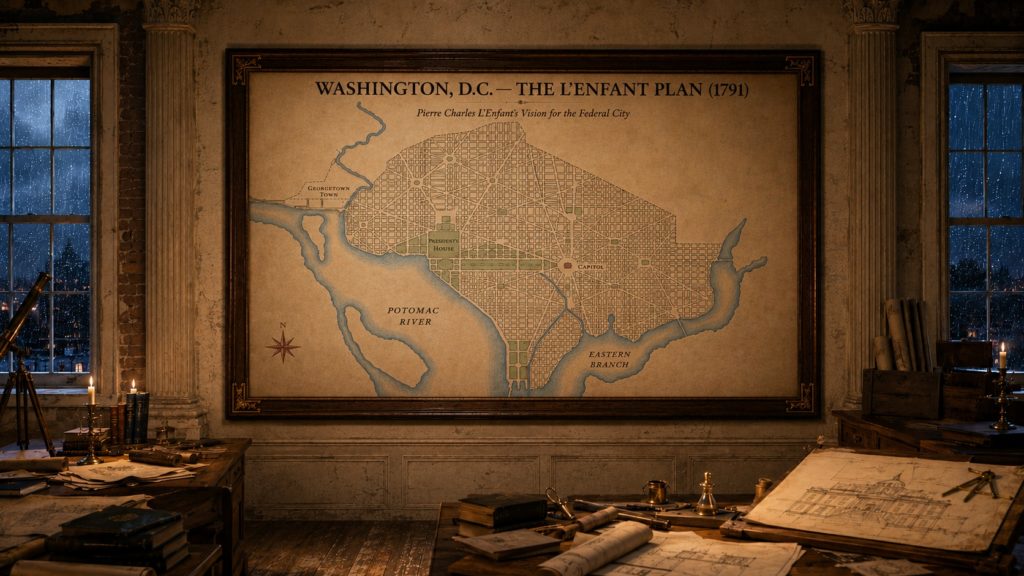
Planning of Washington, D.C.
A political compromise over war debt put America's future capital on a stretch of Potomac riverbank: Hamilton proposed the trade in June 1790, securing votes to fund state debts in exchange for the capital's location.[1]
What Happened
The story
In July 1790, Congress passed the Residence Act[2, p. 6], authorising a permanent federal capital on the Potomac River — the product of a political bargain in which Alexander Hamilton secured southern votes for federal assumption of state debts in exchange for the capital's location[3, p. 6].
President Washington personally selected the specific site[4, p. 1]. Surveyor Andrew Ellicott was commissioned to lay out the ten-mile-square federal district[5, p. 4], assisted for a time by Benjamin Banneker[5, p. 6], while Pierre Charles L'Enfant was engaged to design the new “Federal City” itself[6].
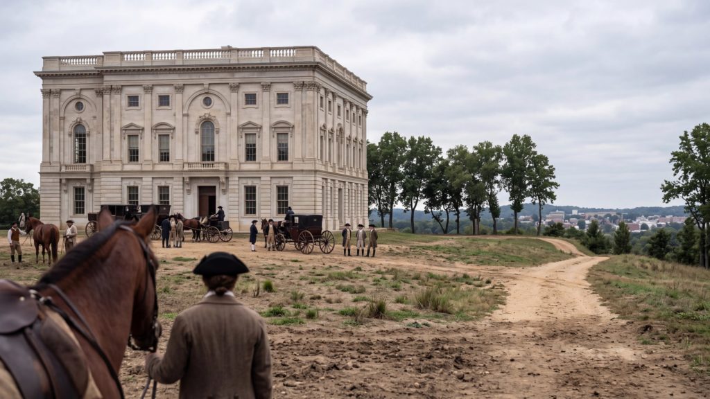
L'Enfant produced an ambitious plan of broad avenues and open squares for the new capital[3, p. 9], but his uncompromising approach brought him into repeated conflict with the city's commissioners, and President Washington dismissed him from the project on 1 March 1792[7].
Ellicott was able to reconstruct L'Enfant's plan from memory and surviving notes after his dismissal[5, p. 23], and this reconstructed plan became the enduring template for the capital's streets, squares, and monuments[2, p. 12].
Quick Facts
The essentials
Quick Facts
The Bigger Picture
Part of the new federal government's effort to establish permanent institutions after the Constitution's ratification, tied to a wider political bargain over federal assumption of state debts[9].
How It Came To This
Congress passed the Residence Act in July 1790, establishing a permanent federal seat on the Potomac[10, p. 56], following a bargain in which Alexander Hamilton secured southern votes for federal assumption of state debts in exchange for the capital's location there[3, p. 6].
What Actually Happened
President Washington personally selected the specific site[4, p. 1]. Surveyor Andrew Ellicott was commissioned to lay out the ten-mile-square federal district[5, p. 4], assisted for a time by Benjamin Banneker[5, p. 6], while Pierre Charles L'Enfant was engaged to design the city itself[6]. Disputes with the city's commissioners led Washington to dismiss L'Enfant from the project on 1 March 1792[7].
Why It Still Matters
Ellicott was able to reconstruct L'Enfant's plan from memory and surviving notes[5, p. 23], and it became the enduring template for the capital's avenues, squares, and monuments[2, p. 12].
Quick Facts
Roger has entered the historical rabbit hole…
The nation's capital exists partly because of a political trade. In 1790, Thomas Jefferson and Alexander Hamilton struck a bargain linking federal assumption of state war debts to placing the capital on the Potomac[11, p. 1].
Keith checked the fine print…
The Constitution allowed a federal district of no more than ten miles square[12], a deliberately modest limit meant to reassure states wary of handing the new national government too much ground of its own.
One for the Ageonauts…
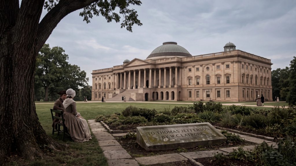
Washington personally chose the site for the President's House on a low ridge above the Potomac[13, p. 5], making him the only president who picked the ground his own official residence would later stand on.
Keith has spotted the surveyor…
The ten-mile-square federal district's boundary work involved Benjamin Banneker, a self-taught Black astronomer and mathematician, whom Jefferson recommended to assist Andrew Ellicott with the preliminary survey[5, p. 6].
Roger has spotted the friction…
Pierre Charles L'Enfant's grand plan of sweeping avenues never made him popular with the city's own commissioners. Washington dismissed him for insubordination in early 1792, before the city he designed had even been built[4, p. 1].
History has added a footnote…
L'Enfant refused to hand over an approved, publishable version of his own plan, so it was Andrew Ellicott who revised and published the city plan that actually guided Washington's construction through the 1790s[3, p. 9].
Meanwhile, visitors weren't always kind…
Early Washington earned an unflattering nickname: ‘the city of magnificent distances’, mocking its wide, empty avenues connecting buildings that mostly didn't exist yet[14].
Keith would like to clarify…
Benjamin Banneker helped survey the federal district's ten-mile-square boundary from 1791, assisting Andrew Ellicott with the astronomical observations needed to fix its corners precisely[5, p. 4].
Roger says, “Hear me out…”
L'Enfant wasn't hired just to draw streets. Washington wanted a capital that looked powerful and permanent before the young republic actually was either, laying broad avenues over a grid radiating from the Capitol and the President's House[3, p. 8].
File under: surprisingly true…
The 1901–02 McMillan Plan deliberately revived L'Enfant's original vision for Washington after decades of haphazard development had crept over it, restoring and extending the avenues-and-grid design that still shapes the city[2, p. 41].
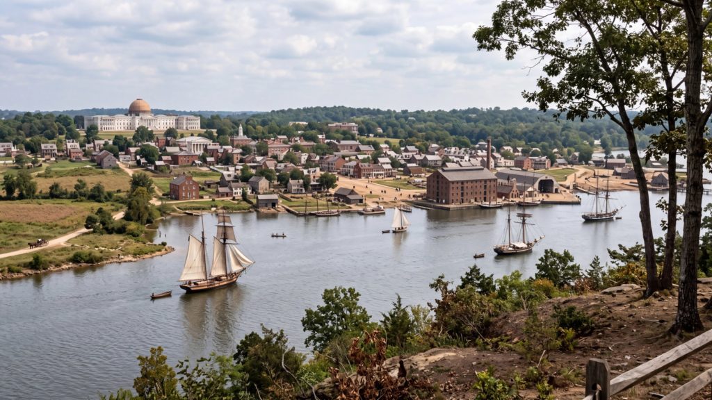
...the west end of Jenkins heights which stand as a pedestal waiting for a monument.[15]
Pierre Charles L'Enfant
From L'Enfant's report to President Washington recommending the site for the Congress building in his plan for the new federal city; the site he described became Capitol Hill.[15]
Timeline
How it unfolded
21 June 1783
Congress Driven From Philadelphia
A mutiny by unpaid soldiers in Philadelphia, which the local authorities would not call out the militia to suppress, forced the Continental Congress to leave the city and adjourn to Princeton, New Jersey.[16] The Jefferson Cyclopedia dates Congress's adjournment to the journals of 21 June 1783.[17, p. 362] The episode left Congress without a secure home and fed the long argument over where a permanent capital should stand.[18]
16 July 1790
Residence Act Chooses the Potomac
Congress approved the Residence Act, placing the permanent seat of government on the Potomac River in a district ten miles square to be selected by the President.[19] It was part of a bargain in which Jefferson and Madison agreed to ease passage of Hamilton's assumption bill, while Philadelphia would serve as temporary capital until the new city was ready in 1800.[3, p. 6]
24 January 1791
Washington Announces the Federal District
President Washington announced the location of the new capital, a diamond-shaped ten-mile tract at the confluence of the Potomac and the Eastern Branch, a mere twelve miles from his Mount Vernon home.[3, p. 6]
9 March 1791
L'Enfant Arrives to Plan the City
Pierre Charles L'Enfant, selected by Washington to prepare a ground plan for the new city, arrived in Georgetown.[20, p. 2] He was a French artist and engineer who had befriended Washington in the Revolutionary War and had requested the honour of designing the capital.[3, p. 7]
15 April 1791
First Boundary Stone at Jones Point
The south cornerstone of the federal territory was formally installed at Jones Point in Alexandria, Virginia, the first of forty boundary stones set at one-mile intervals around the ten-mile diamond.[3, p. 7] The boundaries rested on celestial calculations by Benjamin Banneker, working with surveyor Andrew Ellicott.[3, p. 7]
c. 26 August 1791
L'Enfant Submits His Plan
L'Enfant presented the President with his report and plan for the federal city.[20, p. 2] It combined a grid of streets with diagonal avenues radiating from the sites for Congress and the President's House.[3, p. 7]
9 September 1791
District and City Named
The three commissioners notified L'Enfant that the federal district would be called the Territory of Columbia and the federal city the City of Washington.[21]
c. 1 March 1792
L'Enfant Dismissed
Washington ordered L'Enfant dismissed for insubordination after he refused to furnish his plan to be engraved and published for the lot sale.[22, p. 91] His assistant Andrew Ellicott continued the execution of the plan, and Jefferson soon organised a design contest for the President's House.[4, p. 1]
18 September 1793
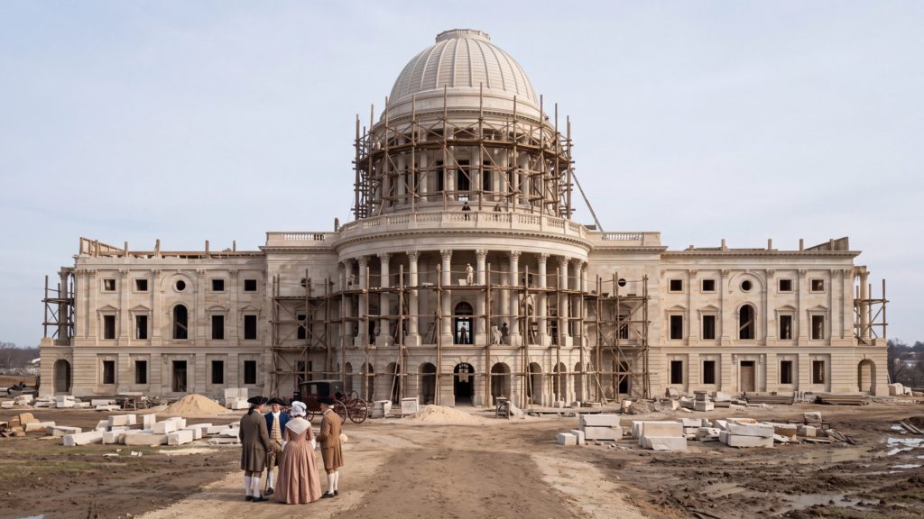
Capitol Cornerstone Laid
Washington laid the southeast cornerstone of the Capitol in a Masonic ceremony, the first of the great public buildings to be begun in the new city.[23][8]
17 November 1800
Government Moves to Washington
With the wings of the Capitol sufficiently prepared, the government removed to the District on 17 November 1800, ten years after the Residence Act.[24] Only the north wing of the Capitol was finished, and the Senate met in a two-story room on its ground floor.[25, p. 2]
Dig Deeper
Copy any prompt below into your favourite AI chat to keep exploring.
Explain Pierre Charles L'Enfant's design plan for Washington D.C. and what it was meant to symbolize.
What does it mean to design a capital to look powerful before the country actually is?
Pitch L'Enfant's plan like a real-estate agent trying to sell a city that doesn't exist yet.
Further Reading
Where to read more
L'Enfant-McMillan Plan of Washington, DC — Library of Congress (HABS)
The Library of Congress's Historic American Buildings Survey overview of Pierre L'Enfant's 1791 plan for the federal city and its later revival.
Why look at this: Explains in a few paragraphs why L'Enfant's radiating avenues were meant to look like a baroque European capital, and why the design still shapes the city over two centuries later.
https://www.loc.gov/resource/hhh.dc0776.sheet/?sp=2The Capital, Episode 3: ‘Guided by the Stars’ — PBS
A PBS documentary episode following surveyor Andrew Ellicott's work translating L'Enfant's vision into the precise, on-the-ground boundaries of the new federal district.
Why look at this: Goes beyond L'Enfant's famous avenues to show the unglamorous surveying work — including Benjamin Banneker's contribution — that actually turned the plan into fixed ground.
https://www.pbs.org/video/episode-3-guided-by-the-stars-pv7u7x/Plan of the City of Washington (1791) — Library of Congress Geography and Map Division
A digitized historical reproduction of L'Enfant's original 1791 manuscript plan for the federal city.
Why look at this: Lets you look directly at the radiating avenues and sightlines L'Enfant drew over a city that, at the time, barely existed.
https://www.loc.gov/resource/g3850.ct000509/Related
Keep exploring




Can be seen in
Where this shows up

References
Sources
Sources
- BookA portrait of Old George Town by Grace Dunlop Peter ↑
- WebsiteFederal Interest Report and Findings (Draft, September 2013) - National Capital Planning Commission. Pages 6, 12, 41. ↑
- WebsiteL'Enfant Plan of the City of Washington, District of Columbia - National Register of Historic Places Registration Form. Pages 6, 7, 8, 9. ↑
- WebsiteClassroom Resource Packet: Designing the White House 1792-1830. Page 1. ↑
- WebsiteBenjamin Banneker and the Survey of the District of Columbia, 1791 (Records of the Columbia Historical Society, via…. Pages 4, 6, 23. ↑
- BookMaj. Pierre Charles L'Enfant, the Unhonored and Unrewarded Engineer by James Dudley Morgan ↑
- DocumentCatholic Encyclopedia (1913)/Pierre-Charles L'Enfant ↑
- BookThe national Capitol : its architecture, art and history by George Cochrane Hazelton ↑
- BookJames Madison by Sydney Howard Gay ↑
- BookThe writings of James Madison : comprising his public papers and his private correspondence, including numerous letters and… by James Madison and Gaillard Hunt. Page 56. ↑
- WebsiteWashington D.C.: The Growth of a Capital City (NPS newspaper). Page 1. ↑
- BookDocumentary history of the construction and development of the United States Capitol building and grounds .. by United States. Congress. House. Commission on Construction of House Office Building ↑
- WebsiteHistorical Background on the Height of Buildings Act (Draft) - National Capital Planning Commission. Page 5. ↑
- BookThe true Thomas Jefferson by William Eleroy Curtis ↑
- BookWith Americans of Past and Present Days by J. J. Jusserand ↑
- BookThe life and times of Alexander Hamilton : aide-de-camp, secretary, and minister of General Washington; illustrating the history… by Christopher James Riethmüller ↑
- BookThe Jeffersonian Cyclopedia : a comprehensive collection of the views of Thomas Jefferson by Thomas Jefferson and John P Foley. Page 362. ↑
- BookThe Life of George Washington, Vol. 5 by John Marshall ↑
- BookAlexander Hamilton by Henry Jones Ford ↑
- WebsiteOriginal Plan of Washington, D.C. (George Mason University Digital History). Page 2. ↑
- BookWith Americans of past and present days by J. J. Jusserand ↑
- BookWashington's southern tour, 1791 by Archibald Henderson. Page 91. ↑
- BookHistoric buildings of America : as seen and described by famous writers ↑
- BookAddress of Hon. John C. Breckinridge, vice president of the United States : preceding the removal of the… by John C. Breckinridge ↑
- WebsiteThe Old Senate Chamber 1810-1859 (US Senate Historical Office). Page 2. ↑